- Call us Via Whatsapp: +84 (0) 832 126 699
4.9 stars on our site
(15,000 reviews)
- Monday - Sunday : 08:00 - 17:00
(15,000 reviews)

For cyclists seeking an immersive and adventurous journey across Vietnam, the Ho Chi Minh Highway is a dream come true. Following the historic path once used during the Vietnam War, this road now offers one of the most scenic and rewarding long-distance rides in Southeast Asia.
Whether you're planning a solo expedition or looking to join a supported group ride, having a detailed Ho Chi Minh Highway cycling map is essential. This guide provides everything you need to know about the route—its highlights, terrain, essential planning tips, and how to enjoy it safely and comfortably with the help of Golden Cycling Tours.
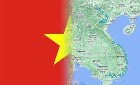
The Ho Chi Minh Highway is a north-south road network that runs parallel to Vietnam’s western border with Laos and Cambodia. Originally a military supply route during the war, it has since been transformed into a well-paved highway stretching over 1,000 kilometers.
Unlike the busy coastal Highway 1, this inland route passes through remote mountains, lush valleys, ethnic minority villages, and untouched forests—offering a truly authentic cycling experience.
Low traffic and peaceful roads
Incredible natural beauty, especially in central Vietnam
Cultural encounters with ethnic groups and rural communities
Plenty of climbing and descending for those who love elevation
Historic war sites and memorials scattered along the route
It's a physically demanding but unforgettable ride that combines history, nature, and adventure in one powerful journey.
While the highway extends from Hanoi to Ho Chi Minh City, most cyclists focus on the central portion—from Phong Nha to Kon Tum or Buon Ma Thuot—where the terrain and scenery are most dramatic.
Here’s a recommended cycling route divided into manageable stages:
Distance: ~130 km over two days
Ride through jungle-covered limestone mountains, remote villages, and the famous Phong Nha-Ke Bang National Park. Stop to explore Paradise Cave or Phong Nha Cave by boat.
Distance: ~140 km
Pass through historical war zones like the Rockpile, Dakrong Bridge, and Khe Sanh Combat Base. Climb scenic passes into the highlands of A Luoi, then descend toward Hue for a cultural break.
Distance: ~170 km over two days
Ride inland through Prao, an ethnic minority town in the forested hills. Then glide back down to sea level into Hoi An, a UNESCO heritage town with ancient charm.
Distance: ~170 km
Transfer part of the way, then cycle into the Central Highlands, reaching Kon Tum, a region known for its wooden churches, tribal communities, and war-era landmarks.
Distance: ~190 km
Enjoy coffee country, pine-covered hills, and peaceful riding. You’ll pass waterfalls, rubber plantations, and quiet farming villages.
Distance: ~350 km (usually split over 4–5 days or partly transferred)
This stretch offers more developed infrastructure but also more traffic. Ideal for seasoned cyclists looking to complete the full highway.
Golden Cycling Tours can help customize this route based on your time, fitness level, and desired highlights.
The Ho Chi Minh Highway crosses mountains, rivers, and dense rural regions. Cellular coverage is limited in some areas, so a GPS-based or offline cycling map is crucial. Good maps help with:
Elevation planning (expect daily climbs)
Locating accommodations and food stops
Identifying road conditions (some older sections are rough)
Staying on the correct branch (the highway splits in some parts)
Golden Cycling Tours provides detailed cycling maps, GPS files, and real-time support on their guided and self-guided tours.
Choosing a guided cycling tour with Golden Cycling Tours ensures you ride this challenging route safely and with peace of mind:
✅ Modern mountain or touring bikes
✅ Helmet and safety gear
✅ English-speaking local cycling guide
✅ Support van for luggage and emergencies
✅ Comfortable lodging (hotels and homestays)
✅ All meals, water, and snacks
✅ War site visits and cultural stops
✅ Digital cycling map + GPS support
They also offer e-bike options, custom tour lengths, and logistics for groups or solo travelers.
Best Time to Go: October to April offers dry and cool weather, ideal for long-distance riding. Avoid the rainy season in the central highlands.
Fitness Required: Moderate to advanced. Daily climbs can reach 800–1,200 meters.
Navigation Tools: Download GPS maps using apps like Komoot, Ride with GPS, or Maps.me
Safety: Wear a helmet, carry basic tools, and bring electrolytes.
Cultural Sensitivity: In minority villages, dress modestly and always ask before taking photos.
“Riding the Ho Chi Minh Highway was the highlight of my Vietnam trip. The roads were quiet, the landscapes wild, and the history was alive. Having a guide from Golden Cycling Tours made all the difference.”
— Oliver J., Australia
“We followed the cycling map provided and it was spot on. Every day brought new surprises—from misty hills to war museums. A must-do route for serious riders.”
— Lisa M., UK
“Epic ride, remote roads, and unbelievable views. The support van gave us flexibility, and the GPS files kept us confidently on track.”
— Takashi S., Japan
No. It’s best for intermediate to experienced cyclists due to the elevation and remote conditions. However, e-bikes and support van access make it manageable for fit beginners.
Absolutely. Most riders focus on the Phong Nha to Kon Tum section. Golden Cycling Tours can customize your tour length and region.
Yes, with preparation. Still, due to remoteness and lack of English speakers in some areas, guided tours are strongly recommended.
Yes. Golden Cycling Tours offers downloadable cycling maps, GPS files, and printed route guides.
Visit Golden Cycling Tours to see itinerary options, request custom tours, and book directly online.
The Ho Chi Minh Highway cycling map isn’t just a navigational tool—it’s your gateway to one of Vietnam’s most epic cycling adventures. This route offers a raw, real, and richly rewarding journey through the mountains, forests, and history of Vietnam.
Whether you ride solo with a GPS or join a fully supported tour with Golden Cycling Tours, this road promises challenge, discovery, and connection on every turn of the pedal.
Plan it right. Ride it well. And remember every kilometer.


Leave a Reply
Your email address will not be published. Required fields are marked *