The Ultimate Vietnam Cycling Route Map: Navigating the 1,600km Cross-Country Odyssey
To look at a Vietnam cycling route map is to gaze upon a blueprint for one of the greatest adventures on Earth. Stretching from the humid, tropical lowlands of the Mekong Delta to the mist-shrouded limestone cathedrals of the far north, the route spans over 1,600 kilometers of ever-changing terrain. Navigating this "S-shaped" land on two wheels requires more than just a GPS; it requires an understanding of the topography, the seasonal weather patterns, and the hidden backroads that turn a standard trip into a soul-stirring journey.
For the international cyclist, a well-planned map is the difference between struggling on dusty industrial highways and gliding through emerald-green rice paddies. In this exhaustive guide, we dive deep into the anatomy of the perfect Vietnamese cycling route. We will explore the legendary coastal roads, the rugged highland trails, and how Golden Cycling Tours provides the professional logistics and local insight to bring your map to life. Whether you are charting a South to North Vietnam cycling expedition or an epic North to South traverse, your roadmap to discovery starts here.
The Ultimate Vietnam Cycling Route Map: Navigating the 1,600km Cross-Country Odyssey
Understanding the Topography: An Overview of the Terrain
Before zooming in on specific waypoints, one must understand the three distinct geographical zones that define any Vietnam cycling route map.
The Southern Plains and the Mekong Labyrinth
The southern tip of the map is dominated by the Mekong Delta. This is the flattest region of the country, characterized by a massive network of canals, rivers, and narrow paved levee paths. For cyclists, this is the "warm-up" zone—a place to find your cadence without the pressure of steep gradients.
The Central Coastal Shelf and the Annamite Range
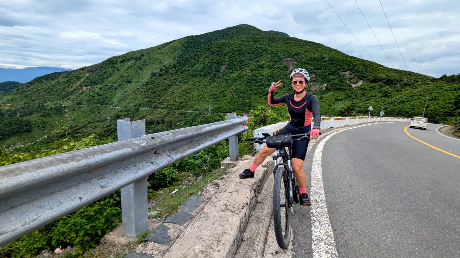
As you move toward the center of the map, the mountains begin to nudge closer to the sea. This creates a spectacular landscape where the road winds between rugged cliffs and sapphire bays. This is also where the map gets "spiky," featuring legendary climbs like the Hai Van Pass and the rolling hills of the Vung Ro Bay area.
The Northern Frontier: Karsts and Terraces
The top of the map is the most dramatic. Here, the limestone karsts of Ninh Binh give way to the towering mountains of the Hoang Lien Son range. A Vietnam cycling route map in the north involves significant elevation gain and loss, winding through terraced rice fields that have sustained ethnic minority communities for centuries.
The Master Itinerary: Mapping the South to North Route
The Cycling South to North Vietnam direction is the most popular choice for adventurers. It allows for a gradual increase in physical difficulty, starting with the southern flats and building toward the northern peaks.
Phase 1: The Delta and the Coast (Saigon to Nha Trang)
The Start: Ho Chi Minh City (Saigon).
The Route: Navigating the backroads of Ben Tre and Tra Vinh in the Mekong Delta before heading northeast toward Mui Ne.
Key Mapping Note: Avoid Highway 1 as much as possible. Look for the coastal roads that bypass the heavy industrial traffic, specifically the scenic stretch between Mui Ne and Phan Rang.
Phase 2: The Central Heritage Loop (Nha Trang to Hue)
The Route: Hugging the coast through Quy Nhon, Quang Ngai, and the ancient town of Hoi An.
The "Crown Jewel": The Hai Van Pass. This is the most iconic waypoint on any Vietnam cycling route map.
Key Mapping Note: In Hoi An, spend an extra day mapping out the rural islands like Cam Kim to see traditional woodcarving and mat weaving away from the crowds.
Phase 3: The Northern Grandeur (Hue to Hanoi)
The Route: Passing through the former DMZ area into the karst wonderlands of Ninh Binh.
The Finale: A triumphant entry into Hanoi.
Key Mapping Note: Ensure your map includes the Trang An and Tam Coc valleys in Ninh Binh—these are essential "Ha Long Bay on land" segments that are best explored by bike.
The Alternative Path: Mapping North to South
Choosing a Cycling North to South Vietnam itinerary is often about timing. Many cyclists choose this direction during the spring months to "chase the warm weather" as they move toward the tropical south.
The Logic of the North-to-South Map
Starting in Hanoi allows you to tackle the more challenging northern climbs while your legs are fresh. The map then "unfolds" into the flatter coastal plains and the Mekong Delta, providing a more relaxed conclusion to your 1,600km odyssey.
Critical Waypoints on Your Cycling Map
A truly professional Vietnam cycling route map focuses on these legendary segments:
1. The Mekong Backroads (The South)
These aren't roads in the traditional sense; they are concrete paths through fruit orchards and along canals. They require precise navigation as they often branch off into countless small villages.
2. The Hai Van Pass (The Center)
Rising 500 meters above sea level over a 21km stretch, this pass separates Northern and Southern Vietnam climatically and geographically. It is the physical and spiritual peak of the tour.
3. The Ho Chi Minh Road (The Interior)
For those who want to avoid the coast entirely, the map shifts inland to the Ho Chi Minh Road. This route follows the spine of the Annamite Mountains. It is quieter, more rugged, and offers a deep dive into the jungle-clad interior of the country.
4. Ninh Binh's Limestone Valleys (The North)
Mapping the paths around Hoa Lu and Tam Coc allows you to cycle through narrow valleys where limestone peaks rise vertically from emerald-green paddies.
Practical Navigational Tools for the Road
Digital Mapping (GPS & Apps)
While traditional paper maps have their charm, digital tools are essential for the modern cyclist.
Komoot and Strava: Excellent for finding "heat maps"—routes that other cyclists have successfully navigated.
Google Maps (Offline): Crucial for remote areas where data signals might drop.
Golden Cycling Tours Digital Guides: When you book with us, we provide pre-loaded GPS routes that focus exclusively on safe, scenic backroads.
The "Paper" Reality
Never rely 100% on technology. Always have a physical overview map of the province you are in. Road names in rural Vietnam can be confusing, and local landmarks are often better indicators than digital waypoints.
Why Professional Support Changes Your Map
Navigating 1,600km solo is a daunting task. The "perfect" Vietnam cycling route map is often invisible to the naked eye. It consists of the turn-offs that avoid the dust of Highway 1, the shortcuts through village schools, and the hidden lagoons.
Golden Cycling Tours acts as your live, expert map.
Safety First: Our support vans act as a barrier and a rescue point if you take a wrong turn or encounter mechanical issues.
Logistical Precision: We handle the luggage, the water, and the snacks, so your only "navigation" is enjoying the view.
Local Knowledge: Our guides know the routes that aren't on Google Maps—the paths that take you into the heart of the "Real Vietnam."
Whether you are looking for the South to North epic or the North to South traverse, our team ensures your map is filled with highlights, not headaches.
The Culinary Map: Fueling Your Journey
Your Vietnam cycling route map is also a culinary map.
The South: Fuel up on Hu Tieu and Nuoc Mia (sugarcane juice).
The Center: Spice things up with Bun Bo Hue and Mi Quang.
The North: Savor the original Pho Bo and Bun Cha in the capital.
These roadside stops are the true waypoints of the trip, where you interact with locals and recharge for the next segment of your 1,600km journey.
Seasonal Mapping: When to Ride Each Route
The weather in Vietnam is as diverse as the terrain, and your map must account for it.
Best for South to North (Feb–May): Dry across most of the country.
Best for North to South (Sept–Nov): Catching the harvest colors in the North and moving toward the warmth of the South.
Conclusion: Charting Your Course
A Vietnam cycling route map is the beginning of a life-changing story. It is a document that promises sweat, triumph, beauty, and connection. From the first pedal stroke in the Mekong to the final sunset in the northern mountains, the map is your guide, but the experiences are your own.
Are you ready to bring your map to life? Visit Golden Cycling Tours today and explore our professional South to North and North to South itineraries. The road of a lifetime is just a gear shift away.
Frequently Asked Questions (FAQ)
1. Can I rely on Google Maps for cycling in Vietnam? Google Maps is useful for general directions, but it often directs cyclists onto the busy and dangerous Highway 1. A professional tour uses curated "backroad" maps that Google often misses.
2. What is the total distance of a cross-country tour? The direct route is about 1,600km, but a scenic Vietnam cycling route map that includes backroads and coastal loops usually totals between 1,800km to 2,000km.
3. Are there many steep climbs on the coastal route? Most of the coastal route is rolling or flat, with the notable exception of the Hai Van Pass and a few headlands in the central region. A well-planned map will balance these climbs with easier days.
4. Is it easy to find bike mechanics along the route? In large cities, yes. In rural areas, you will find "xe may" (motorbike) mechanics who can help with basic repairs, but for high-end road or mountain bikes, professional support is highly recommended.
5. How do I avoid the main highways? Look for the "QL" (Quoc Lo) roads on your map but prioritize the "DT" (Duong Tinh) provincial roads. These are generally quieter and more scenic.
Customer Reviews
"The South to North map provided by Golden Cycling Tours was flawless. We spent 90% of our time on quiet village roads that I never would have found on my own. Truly the trip of a lifetime!" — David R., USA
"Navigating Vietnam on my own seemed impossible until I found Golden. Their guides knew every turn and every hidden coffee stop. It made the 1,600km feel like a joy rather than a struggle." — Sarah L., Australia
"The North to South route was incredible. Starting in the mountains and ending in the delta was the perfect progression. The logistics were 5-star!" — Hans K., Germany
Recently, Golden Trail Travel Co., Ltd has identified several
fraudulent attempts in which scammers have used our company name,
logo, images, and brand identity to send fake payment requests to
customers.
These fraudulent emails are typically sent from unofficial email
addresses and may contain fake bank account details with the
intention of deceiving customers and misappropriating funds. This
type of phishing scam has been widely reported and warned against by
organizations and authorities worldwide.
To protect our customers and ensure secure transactions, Golden
Trail Travel and Golden Cycling Tours use ONLY ONE official tax code
and ONE official bank account as detailed below.
We never request customers to transfer payments to any bank
account other than the official account listed above.
Any phone number, email address, or payment information not listed
in this notice may be fraudulent.
If you receive any payment request that appears suspicious, please
contact us immediately through our official hotline or email
addresses to verify the information before making any payment.


Leave a Reply
Your email address will not be published. Required fields are marked *