- Call us Via Whatsapp: +84 (0) 832 126 699
4.9 stars on our site
(15,000 reviews)
- Monday - Sunday : 08:00 - 17:00
(15,000 reviews)

Picture the dawn fog lifting off sheer limestone monoliths as crisp alpine air fills your lungs. Beneath your handlebars, fine mountain gravel crunches rhythmically under high-pressure tires, echoing off vertical cliffs that pierce the clouds. The metallic click-clack of your derailleur shifting into a lower cog signals another sustained 10% gradient ahead. In the valley below, early morning woodsmoke, wild mountain cinnamon, and crushed pine needles perfume the cool breeze. As your calves and glutes surge with power, a breathtaking panorama of emerald terraced fields and deep canyon abysses unfolds before your eyes.
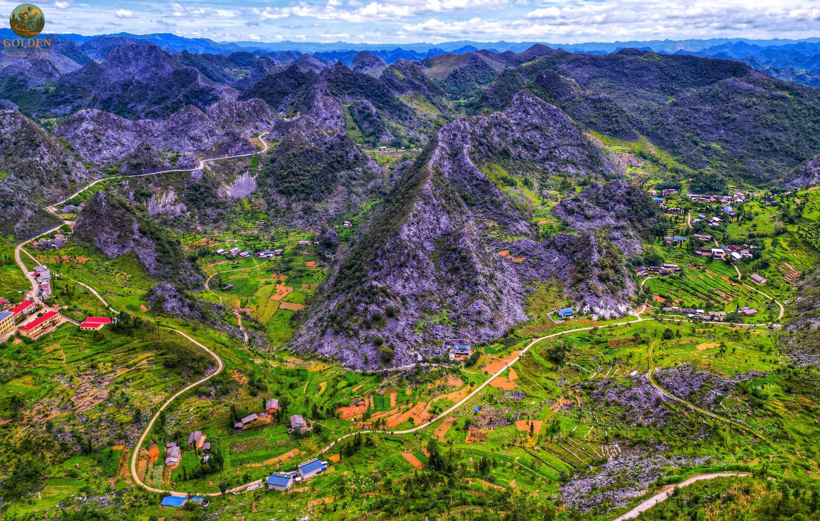
Navigating Indochina’s most dramatic topography requires precise mapping, accurate gradient awareness, and strategic route selection. This comprehensive guide on Northern Vietnam Cycling Maps: Best Elevation Profiles & Routes by Golden Cycling Tours provides complete topographic breakdowns, elevation profiles, weather insights, and route logistics to help you conquer these legendary roads with total confidence.
Understanding terrain elevation profiles is the foundation of planning a successful multi-day cycling expedition across frontier mountain chains.
Mountain passes in Northern Vietnam are defined by continuous altitude gains, sharp switchbacks, and dramatic microclimates. Detailed cycling maps analyze cumulative elevation gain, steepness percentages, and surface transitions from smooth asphalt to loose karst gravel.
Steep Gradients: Legendary passes frequently feature sustained gradients between 6% and 10%, with sharp inner-turn hairpins reaching up to 14%.
Elevation Extremes: Passes elevate riders from low agricultural river basins up to alpine summits surpassing 2,000 meters above sea level, requiring smart pacing and gear selection.
Deciphering these parameters using Northern Vietnam Cycling Maps: Best Elevation Profiles & Routes ensures you choose gear ratios and physical pacing matched to your athletic goals.
Location: Ha Giang province within the UNESCO-listed Dong Van Karst Plateau Geopark.
Elevation Profile: Rises steadily along sheer cliff faces, hanging thousands of feet directly above the turquoise Nho Que River.
Gradient & Ride Quality: Sustained 7% to 9% climbing across 20 kilometers of asphalt, demanding focused bike control and steady cadence.
Location: Connecting Sapa with Lai Chau province across the Hoang Lien Son range.
Elevation Profile: The longest pass in Vietnam, spanning nearly 50 kilometers and reaching summits exceeding 2,000 meters above sea level.
Gradient & Ride Quality: Long alpine ascents with steady 6% to 8% gradients overlooking Mount Fansipan and the sculpted Muong Hoa Valley.
Location: Spanning across Mu Cang Chai.
Elevation Profile: Climbs over 30 kilometers through dense cloud layers and golden rice terraces.
Gradient & Ride Quality: Continuous 7% gradients featuring multiple switchback combinations that test endurance legs.
Whether riding supported or lightweight, mapping how Northern Vietnam's topographies vary helps you craft the ideal multi-day itinerary.
Your cycling expedition often begins in historic Hanoi, where morning air carries the rich aroma of dark-roasted espresso coffee and simmering star anise broth. Warm up your legs on flat terrain by spinning along the leafy perimeter of West Lake, riding across the historic steel beams of Long Bien Bridge, and circling Hoan Kiem Lake. Book our curated hanoi bike tours to kickstart your journey.
In Ninh Binh, vertical limestone towers rise directly out of mirror-like water channels. Elevation profiles here are flat to gently rolling, making riding through Tam Coc, Trang An, and the ancient capital of Hoa Lu ideal gravel warm-ups before hitting high passes. Reserve your trip on our tailored ninh binh bike tours.
West of Hanoi lies Mai Chau, a peaceful valley enclosed by soaring limestone walls. Nearby, Pu Luong Nature Reserve features challenging jungle climbs where giant bamboo waterwheels creak lazily alongside clear streams. Discover these pristine sanctuaries on our mai chau bike tours and pu luong bike tours.
High mountain climbs deliver unbelievable rewards. Ascending toward Sapa, test your skills against O Quy Ho Pass, taking in sweeping views across the sculpted Muong Hoa Valley. Further east, Bac Ha features vibrant Flower H'mong markets filled with mountain spices and colorful textiles. Conquer these alpine routes on our specialized sapa bike tours and backcountry bac ha bike tours.
For ultimate frontier riding, northernmost Vietnam delivers unmatched grandeur. Riding through Ha Giang takes you through the Dong Van Karst Plateau Geopark, conquering Bac Sum Pass, Tham Ma Pass, and Ma Pi Leng Pass. In Cao Bang, gravel routes lead to the roaring mist of Ban Gioc Waterfall. Experience these remote pass routes on our high-end ha giang bike tours and wilderness cao bang bike tours.
Combine regional mountain chains into one multi-day expedition. The dramatic ridges of Vietnam Northwest blend seamlessly with the mystical limestone labyrinths of Vietnam Northeast. Explore our multi-day itineraries for Vietnam Northwest Bike Tours, Vietnam Northeast Bike Tours, and our complete routes for Cycling Northern Vietnam.
Follow the historical backbone of the nation along the iconic Ho Chi Minh Trail. Feel the climate warm as you cycle past dense jungle canopies, historical monuments, and quiet river valleys. For the ultimate cross-country challenge, explore our ho chi minh trail cycling tours and cross-nation Cycling North to South Vietnam packages.
Every mountain pass can be enjoyed with high-torque electric pedal assist, private mechanics, and luxury support vans. Explore our exclusive vietnam luxury bike tours and state-of-the-art vietnam e-bikes tours for the perfect balance of athletic sport and luxury.
Proper nutritional refueling accelerates muscle recovery after demanding mountain climbs. In Hanoi, start your morning with a steaming bowl of Pho Bo filled with tender beef, fresh cilantro, and warm star anise broth. While conquering mountain passes in Ha Giang or Sapa, replenish your energy with tender mountain pork grilled over charcoal with wild Mac Khen pepper berries or hot bamboo-cooked sticky rice known as Com Lam in Mai Chau. Golden Cycling Tours selects clean, authentic farm-to-table restaurants and private homestays where ingredients are harvested daily from local gardens.
Restful sleep is essential for physical recovery. Our itineraries feature hand-selected accommodations designed for comfort and tranquility. Experience eco-luxury resorts with heated infinity pools overlooking mountain ranges in Sapa or peaceful, boutique stilt-house stays in Pu Luong Nature Reserve and Mai Chau. Each property provides plush bedding, modern private bathrooms, hot pressurized showers, bike wash areas, and secure charging stations for e-bike batteries.
From arrival to departure, your journey is handled with absolute precision. Private air-conditioned support vehicles accompany your group throughout the ride. Luggage, extra clothing layers, spare wheels, and medical supplies are transported safely inside the van. Certified mechanics travel inside the vehicle to handle gear tune-ups, tire pressure checks, and brake adjustments after every ride. If weather turns harsh or legs tire on a steep climb, your support van is right behind you.
Riding through remote mountain villages brings you into close contact with Black H'mong, Tay, White Thai, and Red Dzao communities. Respect local customs by removing shoes before entering traditional wooden homestays. Greet hosts warmly with a smile and a gentle nod. When photographing local villagers or market stalls in Bac Ha, ask for permission politely. Using reusable water bottles provided in your support vehicle helps keep mountain ecosystems clean and free of plastic waste.
Timing plays an important role when planning your cycling vacation:
Autumn (September to November): Widely considered the best season for mountain cycling. Days are sunny, roads are dry, humidity is low, and temperatures are pleasantly cool. Shimmering golden rice harvests fill valleys across Mai Chau, Muong Hoa Valley, and Pu Luong Nature Reserve.
Spring (March to May): Another exceptional window for active travel. Mountain slopes bloom with wild plum and peach blossoms while roads remain clear. Packing lightweight layers with a windproof jacket is ideal.
Winter (December to February): Cold and atmospheric in high-altitude destinations such as Ha Giang and Sapa. Fog can reduce visibility on high passes, making front/rear lights, thermal layers, and full-finger gloves essential.
Summer (June to August): Warm and lush with occasional tropical downpours. Morning rides offer clear skies, while afternoon rain requires extra caution on wet descents.
"Studying Northern Vietnam Cycling Maps: Best Elevation Profiles & Routes with Golden Cycling Tours allowed us to prepare perfectly for Ma Pi Leng Pass and O Quy Ho Pass. Having high-spec gravel bikes and support vans right behind us made the entire tour seamless!" — Marcus & Thomas L., Germany
"Our group completed a multi-day route through Sapa and Ha Giang. The elevation maps were spot-on, the boutique homestays were incredible, and the support team was world-class." — Sarah & James P., Australia
O Quy Ho Pass near Sapa is the highest paved pass in Vietnam, reaching an elevation over 2,000 meters above sea level across a nearly 50-kilometer ascent.
Support vehicles follow directly behind your cycling group carrying extra hydration, snacks, medical kits, and spare parts. If a rider experiences fatigue on steep gradients, they can rest inside the vehicle at any time.
Yes! Our mid-drive electric pedal-assist bikes provide smooth torque assistance, making steep 10% gradients manageable for riders of varying fitness levels.
Our custom GPS mapping files are regularly updated by certified local guides to account for recent road paving, weather shifts, and terrain changes across remote mountain corridors.
Ready to conquer Indochina's ultimate roads with absolute precision? Contact Golden Cycling Tours today to plan your ride using our complete guide on Northern Vietnam Cycling Maps: Best Elevation Profiles & Routes.

.jpg "Thai Binh Vietnam Bicycle")
.jpg "Phu Tho Vietnam Cycling")
.jpg "Thai Nguyen Cycling Vietnam")
.jpg "Tuyen Quang Cycling Vietnam")
.jpg "Vinh Phuc Cycling Vietnam")
Leave a Reply
Your email address will not be published. Required fields are marked *